
Do I need chains to get to Boreal right now?
No, there is no chain control on the drive from Sacramento to Boreal right now. Checked (Caltrans).
Read every five minutes from Caltrans chain control (cwwp2.dot.ca.gov), for the direction you drive up. The signs on the road are what you are bound by: confirm at roads.dot.ca.gov or call 511 before you go.
Storm alerts
A notification on this device when chain control starts, changes or lifts, or a road closes or reopens. Pick your roads:
An alert is a heads-up that something changed, not a road report, and it can arrive a few minutes after the change. Before you drive, check Caltrans QuickMap or Nevada 511 (nvroads.com), or call 511. A few alerts a day at most; no account, no email, and you can turn them off here any time (what we keep).
Do you need chains to get to Boreal right now? Live Caltrans chain control on the I-80 climb from Colfax to the Castle Peak exit, checked every five minutes.
The drive from Sacramento and the Bay Area
Boreal is beside I-80 at the Castle Peak exit, the last exit before Donner Summit. The drive from Sacramento is the whole eastbound climb: Colfax, Gold Run, Emigrant Gap, Cisco Grove, Kingvale, then the stretch above Soda Springs.
The answer above reads Caltrans's eastbound checkpoints from Colfax to Castle Peak. Caltrans's Castle Peak point is at the exit itself, so a control posted there is on your last mile. Sugar Bowl shares most of this drive and turns off one exit earlier.
The highest Caltrans checkpoint on the way is Castle Peak on I-80, at 7,247 ft; the lowest is Applegate, at 2,020 ft. Snow at the top of the drive is not snow at the bottom, and the checkpoints in between are where the level changes.
Where Caltrans sets chain control on the way
I-80 east from Colfax to the Castle Peak exit
- Castle Peak · 7,247 ft
- Kingvale · 6,076 ft
- Yuba Gap · 5,770 ft
- Rainbow · 5,734 ft
- Cisco Grove · 5,649 ft
- Nyack · 5,393 ft
- Whitmore · 4,770 ft
- Drum · 4,333 ft
- Baxter · 3,897 ft
- Alta · 3,480 ft
- Gold Run · 3,188 ft
- Colfax · 2,421 ft
- Applegate · 2,020 ft
These are the eastbound checkpoints, the ones you pass on the way up. Coming home, Caltrans's checkpoints in the other direction apply, and they are not always at the same level: read them on the road pages before you leave.
Donner Pass cameras
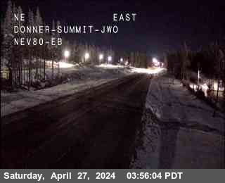 I-80 at Donner Summit · live video
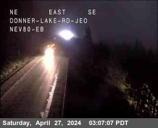 I-80 at Donner Lake · live video
 I-80 at Castle Peak · live video
 I-80 at Soda Springs - Eastbound · live video
All 5 cameras at Donner Pass: I-80 at Donner Summit · I-80 at Donner Lake · I-80 at Castle Peak · I-80 at Soda Springs - Eastbound · I-80 at Kingvale - Westbound · every pass camera
What R-1, R-2 and R-3 mean on the drive to Boreal
Caltrans sets chain control at its control points, in three levels:
- R-1
- Chains, traction devices or snow tires on the drive axle of every vehicle except four-wheel and all-wheel drive, which must still carry chains.
- R-2
- Chains on every vehicle except four-wheel or all-wheel drive with snow tires on all four wheels. Those must still carry chains.
- R-3
- Chains on every vehicle, no exceptions.
Trucks and trailers have rules of their own at every level. Both states' rules, side by side, are on chain control levels R1, R2 and R3 explained.
More for this trip
- Boreal opening day, lifts and snow
- Do I need chains on Donner Pass right now?
- I-80 road conditions and cameras
- What to carry for a Sierra winter drive
The drive to another resort: Heavenly · Palisades Tahoe · Northstar · Kirkwood · Sugar Bowl · Sierra-at-Tahoe
Chain controls and closures: Caltrans (cwwp2.dot.ca.gov), read every five minutes. Nevada Explorer is not affiliated with Caltrans or with Boreal. Always confirm at roads.dot.ca.gov or call 511 before you travel.