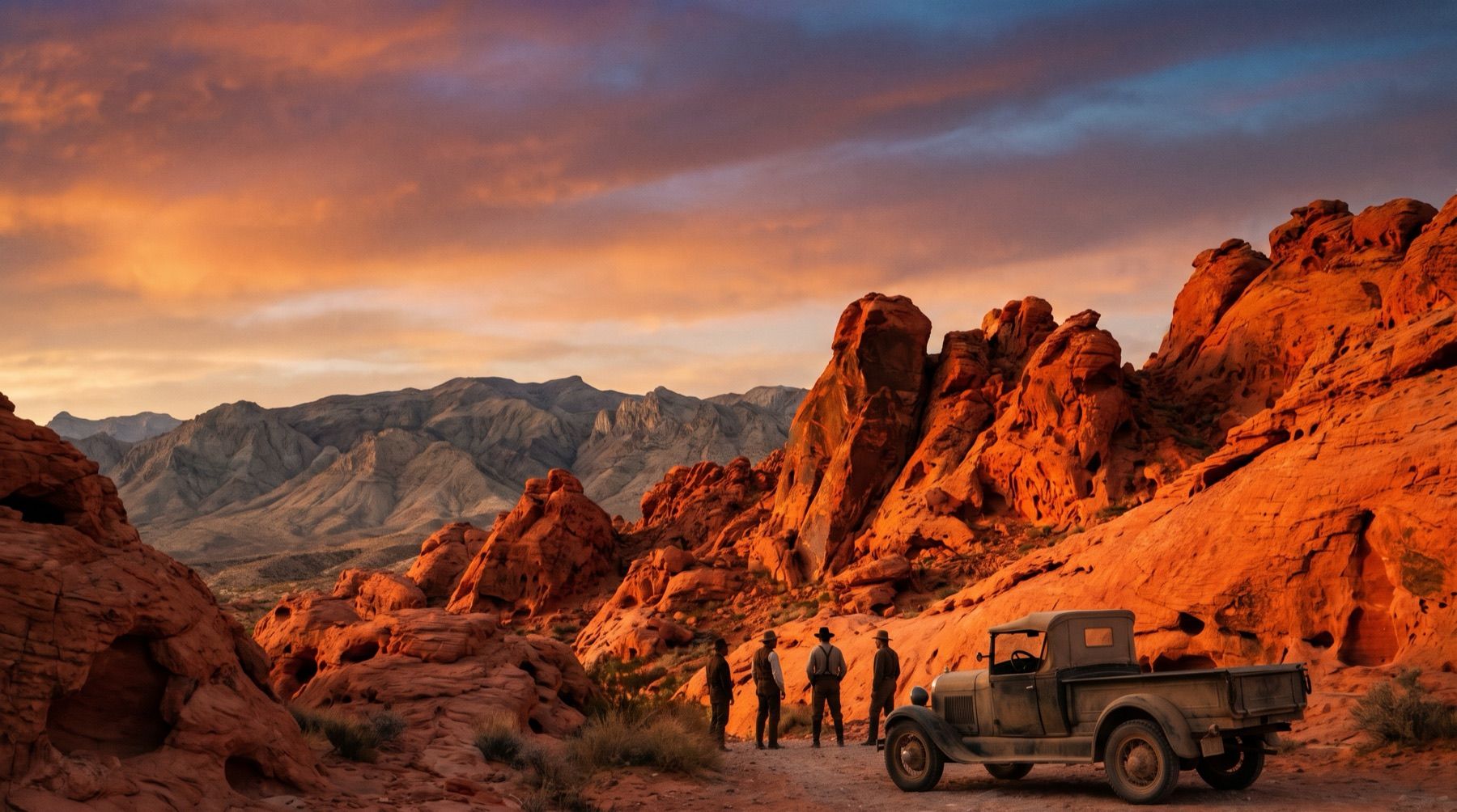
In the late afternoon, the red Aztec sandstone of southern Nevada appears to glow from within. This optical illusion, caused by the angle of the sun hitting the iron-rich rock, prompted an official from the American Automobile Association to declare in the 1920s that the entire valley looked like it was on fire. The name stuck, and the area became known as the Valley of Fire.
Located in Clark County, this landscape of bright red rock formations surrounded by gray and tan limestone mountains holds the distinction of being Nevada's very first state park. Long before it was dedicated to public recreation, the valley served as a vital home, water source, and sacred canvas for prehistoric peoples who left thousands of petroglyphs carved into the dark desert varnish of the sandstone walls.
Shifting Dunes and Ancient Carvings
The geological foundation of the park dates back 150 million years to the Jurassic period. Shifting sand dunes left behind massive deposits of sand after ancient inland seas subsided and the land rose. Over millions of years, these dunes compressed into the Aztec sandstone that defines the park today. Wind and rain carved the red rock into unusual shapes, creating natural arches, deep slot canyons, and towering cliffs. The park's elevations range from 1,500 feet to 3,000 feet, showcasing a stark contrast against the surrounding Mud Mountains.
Humans first entered southern Nevada approximately 11,000 years ago. Around 2,500 years ago, people of the Basketmaker culture began utilizing the valley, followed later by the Early Pueblo culture from roughly 300 B.C. to 1150 A.D. These early inhabitants carved intricate rock art into the sandstone. At Atlatl Rock, a towering detached cliff, prehistoric artists carved representations of the atlatl, a traditional throwing stick used to launch spears before the bow and arrow replaced it in the region about 1,500 years ago.
Another major rock art site is Mouse's Tank, a natural rock basin where rainwater collects in a canyon. Visitors walk to this basin along a sandy path that was once an ancient stream bed. The canyon walls are covered in petroglyphs depicting bighorn sheep, human figures, and geometric patterns. Some carvings show repeated themes, such as a line of human figures holding hands.

The Arrowhead Trail and the Sunset Name
In 1865, Mormon pioneers settled at St. Thomas at the south end of the Moapa Valley, just 11 miles from the red rocks. These settlers, along with local Southern Paiutes, engaged in farming, ranching, and mining along a narrow stretch of water. Decades later, during the construction of Hoover Dam in the early 1930s, the rising waters of Lake Mead permanently flooded the townsite of St. Thomas.
As automobile travel gained popularity across the United States, motorists demanded better roads through the desert. In 1912, workers cleared a rough road through the red rocks as part of the Arrowhead Trail, a highway designed to connect Salt Lake City with Los Angeles. This road allowed the public to access the remote valley for the first time.
In the 1920s, a traveling AAA official coined the name "Valley of Fire" after witnessing the red sandstone formations glowing under the setting sun.
During the 1920s, the scientific and recreational value of the area became clear. Archeologists excavated sites in the region, and advocates began pushing to protect the land. In 1931, a land exchange initiated the transfer of 8,760 acres of federal public domain to the State of Nevada. This original tract formed the core of what would become the state's premier park, establishing a precedent for preserving the state's natural wonders.
The Civilian Conservation Corps and Nevada's First Park
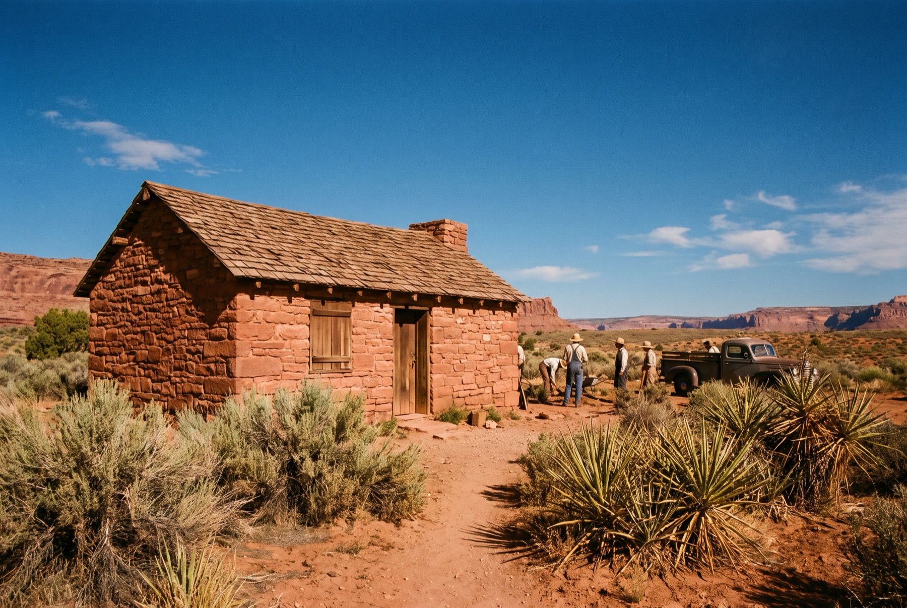
The park's first recreational facilities were built during the Great Depression. In 1933, the Civilian Conservation Corps established camps in the area. Under the leadership of Thomas W. Miller of Reno, who served as the first chairman of the State Parks Commission, CCC crews constructed campgrounds, roads, trails, and stone cabins. The CCC workers built these historic cabins using native red sandstone, providing durable shelters that still stand in the park today.
On Easter Sunday in 1934, the state officially opened Valley of Fire to the public. However, because the Nevada State Legislature did not meet in 1934, the park did not receive its official legislative designation until the body convened in 1935. This legislative action formally established Valley of Fire, along with Beaver Dam, Cathedral Gorge, and Kershaw-Ryan, as the foundation of the Nevada state park system.
The Modern Desert Park
Today, Valley of Fire State Park has expanded to cover 40,000 acres of multi-colored rock. The park is located approximately 50 miles northeast of Las Vegas and 359 miles in a straight line from Reno. Visitors traveling from northern Nevada often take the Reno to Las Vegas Drive via US-95 before heading east toward the Moapa Valley.
The desert environment is extreme, with annual rainfall averaging only four inches. Summer temperatures regularly exceed 100°F, prompting seasonal trail closures from May 15 to September 30 on popular routes like the White Domes Loop, Fire Wave, and Prospect Trail. Additionally, the entire park closes for annual maintenance from December 1 through December 14.
Day-use admission is $10 for Nevada residents and $15 for non-Nevada vehicles. The park is open daily from sunrise to sunset, while the visitor center operates from 9 a.m. to 4 p.m. Travelers can check current regional highway conditions via road conditions and cameras before heading into the southern desert. For those looking for other historic excursions or things to do around Reno and Tahoe, exploring the state's deep history remains one of the most rewarding aspects of reading Nevada stories.