E. McCarran Blvd at I80 Eastbound Offramp
Live camera on I-80, with the current status of the road it sits on and the forecast at the nearest pass.
Weather at Reno
Wind Advisory in effect — Wind Advisory issued September 12 at 1:47AM PDT until September 13 at 2:00AM PDT by NWS Reno NV
- Tonight
- Mostly Clear
- Temperature
- 52°F
- Wind
- 5 to 20 mph
- Zone
- NVZ003
Where this camera is
This camera is the red marker; the blue dots are the other cameras on I-80. Click one to open it.
What this camera shows
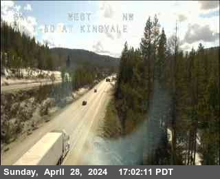
This camera provides a live video feed of the E. McCarran Blvd eastbound offramp area, sitting at an elevation of 4,400 feet. Because this location is significantly lower than the chain control points at Mogul and Gold Ranch, it serves as a reliable indicator of conditions well below the primary mountain weather systems. If this view displays dry or wet pavement while cameras at higher elevations show accumulating snow, you can assume that winter storm conditions are currently confined to the higher passes rather than the Reno valley floor.
Unlike static images that only update periodically, this live stream allows you to monitor real-time traffic flow at this specific interchange. You can see immediately if congestion is building on the offramp or if vehicles are moving freely, which provides a clearer picture of local traffic patterns than the cameras at Battleborn or Kietzke Ln. Use this feed to gauge whether local surface streets are clear before committing to your route toward the interstate.
Chain-control points on I-80
Caltrans does not control the whole road at once — it sets controls at whichever point matches the snow level, so the same storm produces controls at different places on different days. These are the California-side points, highest first:
| Point | Elevation | Near | Now |
|---|---|---|---|
| Castle Peak, (@ DRA Holding only) | 7,247 ft | Norden | Clear |
| DLI (Donner Lake Interchange) | 6,404 ft | Truckee | Clear |
| DLI (Donner Lake Interchange) | 6,404 ft | Truckee | Clear |
| DLI (Donner Lake Interchange) | 6,361 ft | Norden | Clear |
| DLI (Donner Lake Interchange) | 6,361 ft | Norden | Clear |
| Kingvale | 6,076 ft | Soda Springs | Clear |
| Kingvale | 6,076 ft | Soda Springs | Clear |
| Kingvale | 6,069 ft | Soda Springs | Clear |
| Kingvale | 6,069 ft | Soda Springs | Clear |
| Rainbow | 5,921 ft | Soda Springs | Clear |
| Rainbow | 5,921 ft | Soda Springs | Clear |
| Truckee | 5,905 ft | Truckee | Clear |
The cameras either side
More cameras on I-80
- I-80 at Boomtown Garson Rd
- I-80 at Boomtown Truck Check
- I-80 at Gold Ranch
- I-80 at Mahogany Canyon Rd Eastbound
- I-80 at Floriston
- I-80 at Truckee Scales Westbound
Other roads
Camera: Nevada DOT. Chain-control status: Caltrans District 3 (public domain). Nevada Explorer is not affiliated with either. Always confirm at roads.dot.ca.gov or nvroads.com before you travel.