SR-89 road conditions
The west shore, Tahoe City past Emerald Bay to South Lake Tahoe, and north to Truckee and Sierraville.
Weather at Echo Summit
- Tonight
- Mostly Clear
- Temperature
- 49°F
- Wind
- 12 to 22 mph
- Zone
- CAZ136
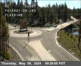
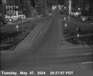
Cameras and chain-control points on SR-89
8 cameras and 26 chain-control points. Click a camera marker to open it.
What to know in winter
Emerald Bay is the first stretch to close and the last to reopen — avalanche terrain above the road.
If it closes: Round the east shore on SR-28 and US-50.
Chain controls come in three levels. R-1 means chains or snow tires. R-2 means chains unless you are in a four-wheel drive with snow tires on all four wheels — this is the one most drivers meet. R-3 means chains on everything, no exceptions, and it usually means a closure is not far behind.
Chain-control points, highest first
Caltrans does not control the whole road at once. Controls go up at whichever point matches the snow level, which is why the same storm produces controls in different places on different days.
No controls are up anywhere on SR-89 right now.
All 21 control points on SR-89
| Point | Elevation | Near | Now |
|---|---|---|---|
| Luther Pass | 7,732 ft | Markleeville | Clear |
| Bliss State Park | 6,840 ft | Tahoma | Clear |
| Emerald Bay | 6,624 ft | South Lake Tahoe | Clear |
| Christmas Valley | 6,505 ft | South Lake Tahoe | Clear |
| Little Truckee Summit | 6,430 ft | Loyalton | Clear |
| Tahoma ( Co line / Sugar Pine ) | 6,332 ft | Tahoma | Clear |
| Tahoma - Eldo / Placer Co Line | 6,305 ft | Tahoma | Clear |
| Harper's Grade | 6,292 ft | Tahoma | Clear |
| Ebrights | 6,289 ft | South Lake Tahoe | Clear |
| Tahoe City | 6,246 ft | Tahoe City | Clear |
| Olympic Valley | 6,171 ft | Olympic Valley | Clear |
| Onion Valley - 17 Miles n/o Truckee | 6,059 ft | Sierraville | Clear |
| Prosser Dam Road - Truckee | 5,977 ft | Truckee | Clear |
| Truckee - West River St | 5,928 ft | Truckee | Clear |
| Hobart Mills | 5,853 ft | Truckee | Clear |
| Hobart Mills - ECC only | 5,853 ft | Truckee | Clear |
| Sattley (Jct. 89/49) | 5,036 ft | Calpine | Clear |
| Sierraville | 5,026 ft | Sierraville | Clear |
| Calpine | 4,973 ft | Calpine | Clear |
| Sattley | 4,937 ft | Calpine | Clear |
| Sierra / Plumas County Line | 4,665 ft | Clio | Clear |
21 control points, collapsed from 26 feed records — Caltrans lists each point once per direction.
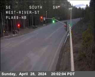
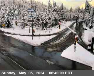
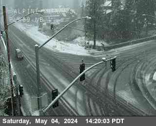
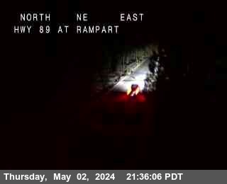
Cameras on SR-89
Other roads
- I-80
The main line between Reno and Sacramento, over Donner Pass.
- SR-431 Mt Rose
The Mt Rose Highway, Reno to Incline Village — the highest year-round pass in the Sierra Nevada.
- SR-267
Truckee to Kings Beach over Brockway Summit.
- SR-28
The north and east shore road, Tahoe City to Incline Village and on to Spooner.
- US-50
Reno and Carson City to South Lake Tahoe and on to Sacramento, over Spooner and Echo Summit.
- US-395
The north–south spine through Reno and Carson City, running south past Gardnerville toward the Eastern Sierra.
- SR-207
Kingsbury Grade, the short climb from the Carson Valley to Stateline and South Lake Tahoe.
- SR-88 Carson Pass
Carson Pass, from the Carson Valley over to Jackson and the Central Valley.
- Reno city cameras
.
Chain-control status, closures and camera images: Caltrans District 3 (public domain) and Nevada DOT / nvroads.com. Weather: National Weather Service — not an official NWS product. Always confirm at roads.dot.ca.gov or nvroads.com before you travel.