I580 / N of US-50 East
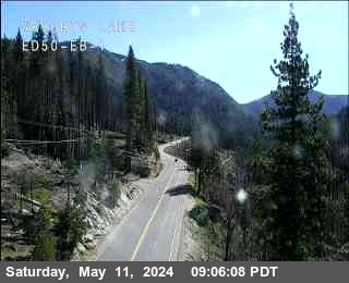
Live camera on US-50, with the current status of the road it sits on and the forecast at the nearest pass.
Weather at Mt Rose Summit
Wind Advisory in effect — Wind Advisory issued September 12 at 1:47AM PDT until September 13 at 2:00AM PDT by NWS Reno NV
- Tonight
- Mostly Clear
- Temperature
- 42°F
- Wind
- 40 to 45 mph
- Zone
- NVZ002
Where this camera is
This camera is the red marker; the blue dots are the other cameras on US-50. Click one to open it.
What this camera shows
This live video feed captures the interchange where I-580 meets US-50, providing a clear view of traffic flow at an elevation of 4,668 feet. Because this position is significantly lower than the mountain passes at Meyers, Chiapa, or Echo Summit, it often remains clear even when those higher points are experiencing winter conditions. This stream is most useful for confirming if traffic is moving freely through the interchange before you begin the climb toward the higher elevations where chain controls are typically enforced.
Since this is a live video stream rather than a static image, you can observe real-time traffic volume and speed directly. If the higher cameras show snow or restricted conditions, checking this feed helps determine if backups are already forming at the base of the ascent. It serves as a reliable indicator of the conditions at the start of your journey, allowing you to gauge whether the road is flowing normally or if congestion is building before you reach the mountain grades.
Chain-control points on US-50
Caltrans does not control the whole road at once — it sets controls at whichever point matches the snow level, so the same storm produces controls at different places on different days. These are the California-side points, highest first:
| Point | Elevation | Near | Now |
|---|---|---|---|
| Echo Summit (Holding only) | 7,401 ft | South Lake Tahoe | Clear |
| Chiapa (Holding only) | 6,453 ft | South Lake Tahoe | Clear |
| Meyers | 6,341 ft | South Lake Tahoe | Clear |
| Meyers | 6,341 ft | South Lake Tahoe | Clear |
| Twin Bridges | 6,158 ft | Twin Bridges | Clear |
| Twin Bridges | 6,158 ft | Twin Bridges | Clear |
| Twin Bridges | 6,158 ft | Twin Bridges | Clear |
| Twin Bridges | 6,158 ft | Twin Bridges | Clear |
| Strawberry | 5,728 ft | Twin Bridges | Clear |
| Strawberry | 5,728 ft | Twin Bridges | Clear |
| Wright's Lake | 5,515 ft | Kyburz | Clear |
| Wright's Lake | 5,515 ft | Kyburz | Clear |
The cameras either side
More cameras on US-50
- US-50 at US-395
- US-50 at Truck Escape Ramp
- US-50 at Golf Club
- US-50 at Spooner Summit
- US-50 at Glenbrook
- US-50 at Cave Rock
Other roads
Camera: Nevada DOT. Chain-control status: Caltrans District 3 (public domain). Nevada Explorer is not affiliated with either. Always confirm at roads.dot.ca.gov or nvroads.com before you travel.