US-395 : North of SR-14 2
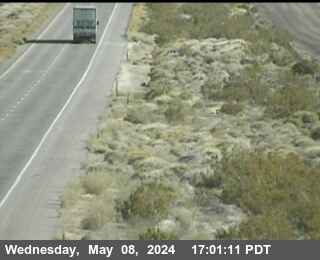
Live camera on US-395, with the current status of the road it sits on and the forecast at the nearest pass.
Weather at Echo Summit
- Tonight
- Mostly Clear
- Temperature
- 49°F
- Wind
- 12 to 22 mph
- Zone
- CAZ136
Where this camera is
This camera is the red marker; the blue dots are the other cameras on US-395. Click one to open it.
What this camera shows
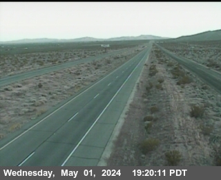
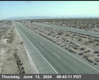
This camera provides a specific look at a segment of the highway situated at an elevation of 2,522 feet. Because this unit sits between other monitoring points at the exact same elevation, it serves as a precise check on localized conditions rather than a measure of changing terrain. If the frames from the adjacent cameras show clear conditions while this one displays moisture or accumulation, it indicates a highly localized weather cell or drift pattern affecting this specific stretch.
As this is a still image that refreshes approximately once per minute, it is best used to confirm pavement surface conditions rather than traffic flow. If the image appears completely dark or obscured by fog, wait for the next refresh cycle before assuming the road is blocked. While this elevation is generally lower than the high mountain passes, checking this view remains essential for detecting sudden wind-blown snow that can create slick spots even when conditions elsewhere appear mild.
The cameras either side
More cameras on US-395
- US-395 at Airport Rd
- US-395 at Gardnerville RWIS
- US-395 at Leviathan Mine Southbound
- US-395 at Coleville / SR-108 Sonora Junction
- US-395 at Bridgeport
- US-395 at Lee Vining / Conway Summit
Other roads
Camera: Caltrans. Chain-control status: Caltrans District 3 (public domain). Nevada Explorer is not affiliated with either. Always confirm at roads.dot.ca.gov or nvroads.com before you travel.