US-395 : McGee Creek Road
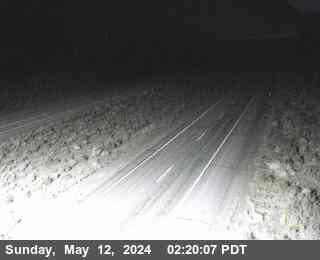
Live camera on US-395, with the current status of the road it sits on and the forecast at the nearest pass.
Weather at Echo Summit
- Tonight
- Mostly Clear
- Temperature
- 49°F
- Wind
- 12 to 22 mph
- Zone
- CAZ136
Where this camera is
This camera is the red marker; the blue dots are the other cameras on US-395. Click one to open it.
What this camera shows
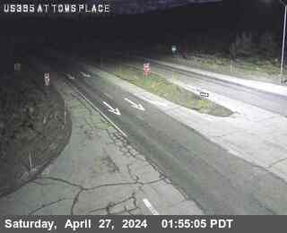
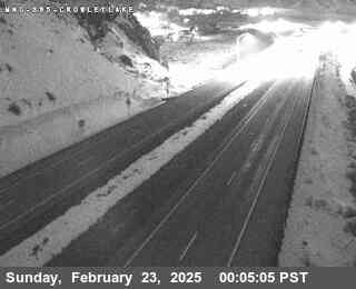
This camera sits at an elevation of 6,906 feet, placing it right between the Tom's Place location to the north and the Crowley Lake view to the south. Because it is positioned lower than the 7,037-foot elevation at Tom's Place, this feed serves as a critical indicator for changing conditions. If the higher camera shows accumulating snow or active precipitation while this view remains clear, it helps determine if a storm is staying at higher altitudes or descending toward the valley floor.
Since this feed provides a still image that refreshes approximately once a minute, it is best used as a snapshot of current pavement visibility. If the frame appears dark or obscured by fog, wait for the next refresh cycle to confirm the conditions rather than relying on a single, potentially outdated image. Comparing this view against the adjacent cameras provides the most accurate assessment of whether road surface conditions are improving or deteriorating along this specific corridor.
The cameras either side
More cameras on US-395
- US-395 at Airport Rd
- US-395 at Gardnerville RWIS
- US-395 at Leviathan Mine Southbound
- US-395 at Coleville / SR-108 Sonora Junction
- US-395 at Bridgeport
- US-395 at Lee Vining / Conway Summit
Other roads
Camera: Caltrans. Chain-control status: Caltrans District 3 (public domain). Nevada Explorer is not affiliated with either. Always confirm at roads.dot.ca.gov or nvroads.com before you travel.